|

|
|
|
| ||
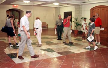
 MAP ROOM--Visitors walk on the state map in the lower level at the Ohio Statehouse, in Columbus Ohio, on Monday, July 8, 1996. The 88 counties that make up the state are represented on the map. |
     |


|

|
|
|
| ||
 MAP ROOM--Visitors walk on the state map in the lower level at the Ohio Statehouse, in Columbus Ohio, on Monday, July 8, 1996. The 88 counties that make up the state are represented on the map. |
     |


